LONGWOOD, Fla. – Jeanismar Rangel was praying to God and sobbing while a tornado[1] bore down on her in Central Florida[2] on Monday as she sat in her vehicle.
Rangel, who recorded the video from the Orlando suburb of Longwood, captured images of rain
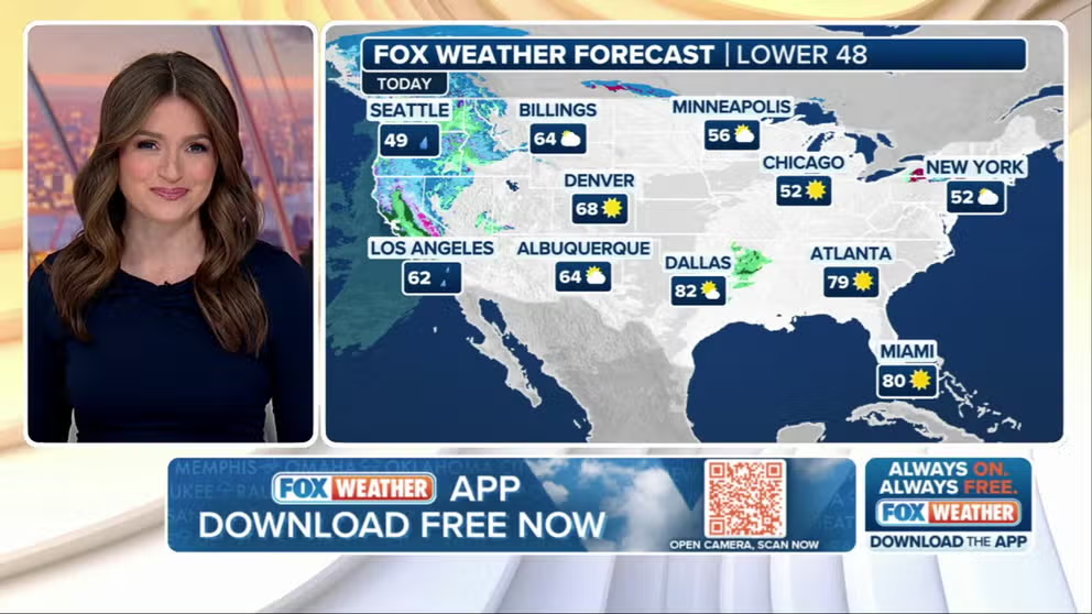
Welcome to the Daily Weather Update from FOX Weather.It's Wednesday, March 12, 2025.Start your day with everything you need to know about today's weather.You can also get a quick briefing of national, regional and local weather[1] whenever you like with
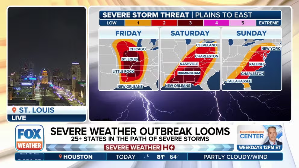
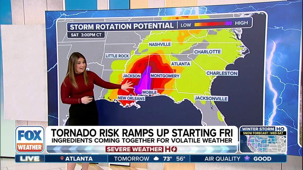
Dangerous severe weather outbreak has over 100 million people in more than 30 states on alert starting Friday. Potential for destructive, hurricane-force wind gusts and strong tornadoes has forecasters concerned. Final days of storms to slam East Coast ...
LOS ANGELES – An atmospheric river event bringing the chances of heavy rain, strong winds and snow to parts of California[1] may cause more problems for residents impacted by recent wildfires.
On Tuesday, authorities around burn scars created by fires such
LAKE MARY, Fla.– Aerial video taken after an EF-2 tornado[1] ripped through a Florida[2] neighborhood north of Orlando[3] shows one home[4] torn to pieces and old oak trees ripped from their roots along a normally quiet community.
Seminole County Fire